🛠️ Zoning Lookup Tool — Technical Breakdown
This application is a browser-based GIS tool built using the ArcGIS API for JavaScript (v4.27), designed to help users search and interactively query zoning information for Marin County, CA.
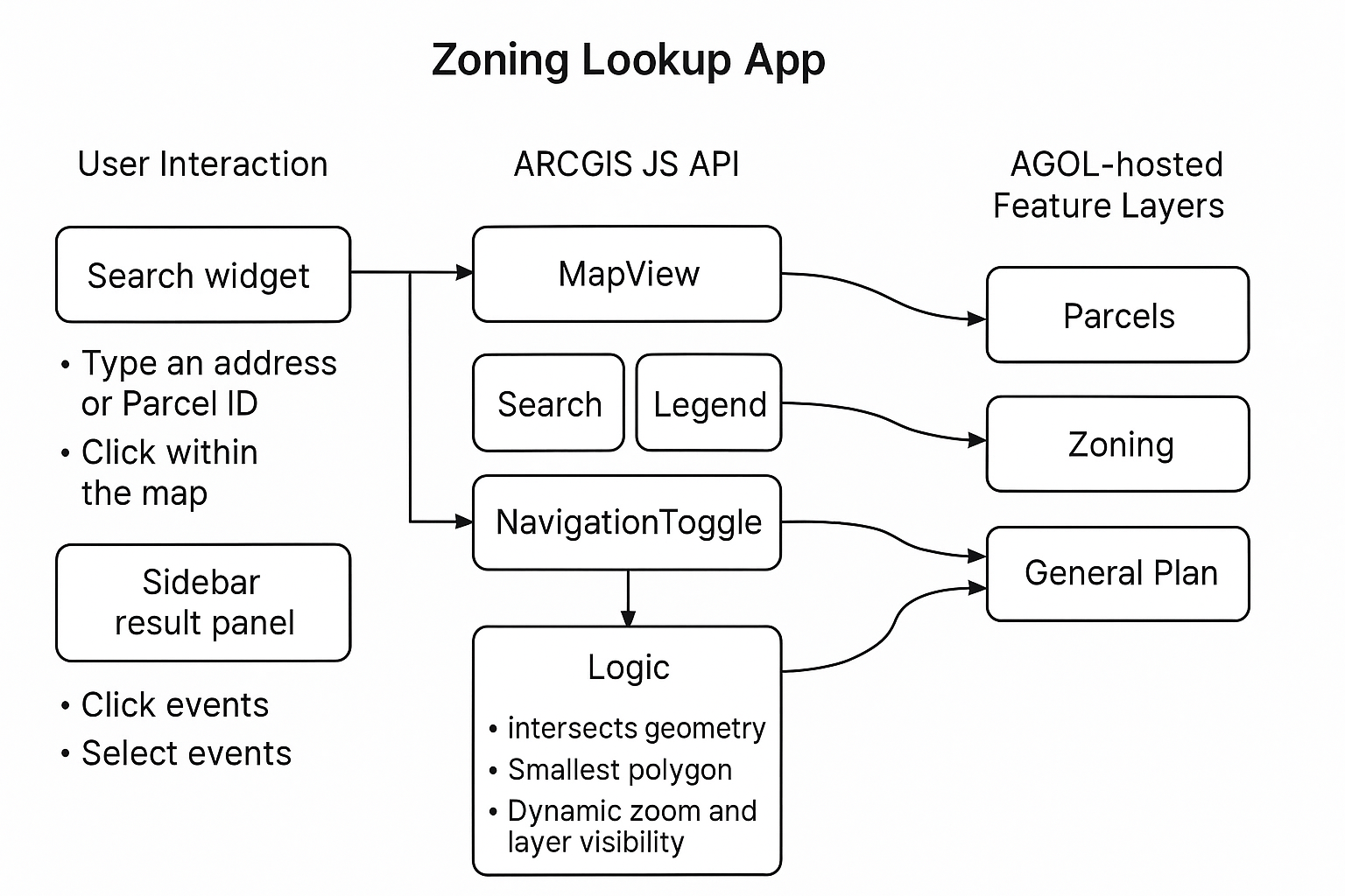
🔧 Features and Architecture
- Framework: The app is written in plain JavaScript and styled with custom CSS and the ArcGIS dark theme.
- Map Initialization: Uses a
MapViewwith a default zoom centered on Marin County. A custom extent is defined for a consistent viewport. - Search Integration: The Esri
Searchwidget enables address and Parcel ID lookups, which triggerFeatureLayerintersections. - Layer Queries: Parcel, zoning, and general plan layers are all hosted in ArcGIS Online and queried dynamically using spatial
intersectsrelationships. - Intersection Logic: A unified query checks all layers and extracts the smallest relevant feature to reduce ambiguity.
- UI Rendering: Results are displayed in a sidebar panel. The view automatically zooms to the selected parcel or clicked feature.
- Performance Optimization: Layers are hidden by default and only displayed at appropriate zoom levels based on
view.scalewatchers.
📦 Tech Stack
- ArcGIS API for JavaScript (CDN)
- Static HTML/CSS/JS, deployed on GitHub Pages
- Hosted ArcGIS Online feature layers
- Fully client-side, no server-side code
🖼️ Architecture Diagram
🔗 Open in a new tab for full responsiveness
Source code available on GitHub.